Hiking the Gap of Dunloe: Ireland’s Most Scenic Mountain Pass
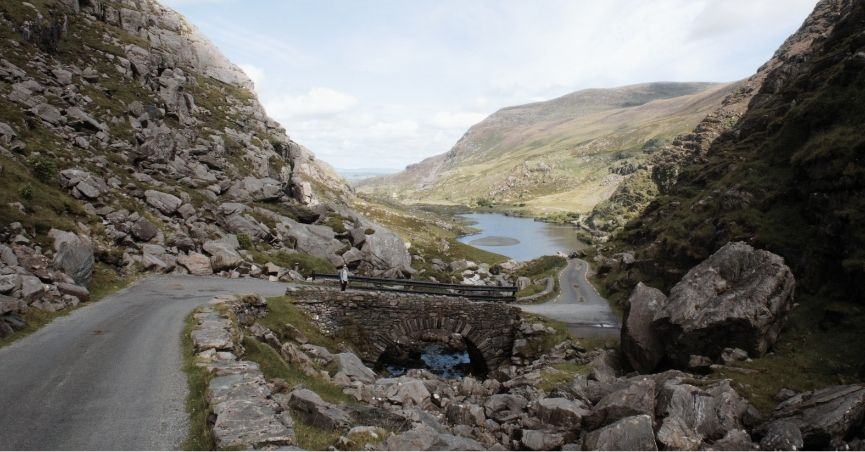
The Gap of Dunloe sits about 12km west of Killarney, cutting through the mountains between the MacGillycuddy’s Reeks and the Purple Mountain Group in a narrow pass carved by glaciers roughly 25,000 years ago. It’s one of the most photographed landscapes in Ireland — and one of those places where the photographs genuinely don’t lie. If anything, they flatten it. The scale of the valley, and the way it shifts and opens as you walk deeper into it, is something that needs to be moved through rather than viewed.
We had it on the itinerary as a morning activity before driving the Ring of Kerry in the afternoon. In hindsight, the Gap deserved the whole day.
Gap of Dunloe Hike Details
Distance: 11 km one way (7 miles)
Total Elevation Gain: 250 meters (800 feett)
Type: one-way or out and back
Terrain: paved road
Time: ~3-4 hours
Overview: Scenic valley walking, glacial landscape, a taste of wild Kerry without technical hiking
Sections in this post
Logistics
Getting There
We drove from Killarney Town — about 20 minutes by car, following signs west toward Beaufort and then Dunloe. There’s a large car park at Kate Kearney’s Cottage at the northern entrance to the Gap. If you don’t have a car, the KY2 bus runs from Killarney to Kate Kearney’s Cottage twice in the mornings, with return services in the afternoon via Ross Castle.
Tip: if you’re planning the full through-hike with the boat return option, you’ll need to sort transport back to your car in advance. We did the out-and-back specifically because we had a rental car parked at the start.
Why Hike It Instead of Drive It?
The road through the Gap is technically open to cars, but driving it is not recommended — particularly in summer. It’s extremely narrow, shared with hikers, cyclists, and horse-drawn jaunting carts, and frequently congested. More importantly, driving it would mean missing the whole point.
Hiking lets you stop every time a view demands it. Move at the pace the landscape sets rather than the pace traffic requires. Hear the sound of the river and the occasional echo of hooves on stone between the valley walls. The Gap is not a destination you reach at the end — it’s a place you inhabit as you move through it.
Your Options for the Route
Option 1: Out-and-Back (what we did) Start at Kate Kearney’s Cottage, walk as far as suits you, and return the same way. We went to the second Wishing Bridge, near the Head of the Gap, for a total of roughly 10km. Good if you have a car parked at the start or have a limited time.
Option 2: Full Through-Hike + Boat Return (the recommended option) Walk the full 11km one-way from Kate Kearney’s Cottage to Lord Brandon’s Cottage, then take a boat through the Lakes of Killarney back toward Ross Castle and Killarney Town. This is the classic and most scenic version — the boat section through the lakes adds a completely different perspective on the landscape. Requires booking the boat in advance and arranging transport. I wish we had done this.
Option 3: Jaunting Cart + Walk Take a traditional horse-drawn jaunting cart one way and walk the other. A good balance of pace and effort.
Our Experience Hiking the Gap of Dunloe
Kate Kearney’s Cottage: The Odd Starting Point
Kate Kearney’s Cottage sits at the northern entrance to the Gap and serves as the practical start of the walk — car park, toilets, a café, and the moment you decide which version of the route you’re doing.
We grabbed coffee at The Coffee Pot Café before setting off, which felt like a slightly incongruous start to a mountain pass hike. The cottage itself raised a few questions we hadn’t thought to look up in advance: was it a single historic building? Did it have historical significance? Was it the name of a community? (The answer: it’s an 18th-century inn named after the local figure Kate Kearney, a woman of legendary beauty who reportedly sold illicit poitín — Irish moonshine — to travellers passing through the Gap. The folklore adds something to the place once you know it.)
The Walk: How the Landscape Changes
The First Section: Country Lane Charm
The opening stretch of the Gap isn’t its most dramatic. The road feels more like a narrow country lane — hedged in by trees and bushes, with pastures visible behind the hedgerows and mountains present but not yet close. The landscape is open and pleasant rather than wild, and the road curves just out of sight ahead, which gives it an adventurous quality even before the scenery intensifies. You’re not entirely sure what’s coming.
This section is still lovely — unmistakably Kerry, everything very green — but it’s more of a prelude than the main event.


The Transition: Moorland and Changing Rock
The country lane quality gradually gives way to something more open and exposed. The vegetation shifts: trees and hedges thin out and are replaced by low-growing heather, mosses, and rough grasses — classic Irish moorland, the kind of landscape that feels ancient in a way that’s hard to articulate. Craggy rocks begin breaking through the surface, getting larger and more prominent as you move deeper in.
This is where the Gap starts to feel genuinely different. The moorland has a particular texture that seems unique to the west of Ireland — craggy rock faces covered in thick moss and grass in shades of green so varied it looks deliberate. Everything is wet enough to be vivid, dry enough to walk. The mountains are closer now, beginning to rise on both sides.


Approaching Black Lake (Coosaun Lough & Black Lake)
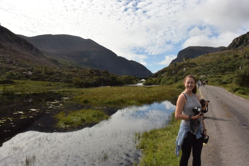
The first lakes appear as you move south — more ponds than lakes by BC standards, which recalibrated our sense of scale somewhat. Coming from somewhere where lakes are vast bodies of water, these felt intimate: small, dark, slightly marshy at the edges, with streams feeding into them through the grass and moss. Rushes and rough vegetation around the margins. Not the blue-mirror stillness of a postcard — more genuinely wild, more like the landscape that holds them rather than a feature separate from it.
The rocks are larger here, and the mountains have closed in considerably.


The Wishing Bridge
Between Coosaun Lough and Black Lake, the route crosses the Wishing Bridge — a rough-hewn stone arch spanning the stream that connects the two lakes. There are apparently two bridges marked on Google Maps in this area; we turned around at the second one, closer to the Head of the Gap.
Local tradition holds that if you pause on the bridge and make a wish, it just might come true — especially if it’s your first time crossing. The story is part folklore, part fairytale, but when you’re standing on a small stone bridge in a glacial valley with the mountains rising around you and a jaunting cart passing quietly in the distance, you feel the magic of it regardless of your position on the metaphysics.
I made a wish. I can’t remember what it was. But I made it.


Auger Lake: The Best Section
From the second Wishing Bridge toward Auger Lake, the landscape reaches its most dramatic — and this was my favourite part of the hike.
The mountains have narrowed in from both sides, making the valley feel enclosed and remote. The path is flanked by steep, craggy slopes rising to genuine mountain height, all grass and moss and exposed rock. The scale is different here from the earlier sections — more towering, more present, more wild.
It felt remote in a way that the earlier sections, lovely as they were, didn’t quite achieve. Almost desolate. There was very little wildlife visible — just the landscape, which is plenty. On the hill above Auger Lake, looking back toward Kate Kearney’s Cottage, the perspective across the lake is one of the best views on the whole route.
The road postcard-perspective thing works perfectly here: the narrow road curves and narrows toward a horizon that seems to vanish into the mountain, exactly like a child’s drawing of perspective, exactly like Ireland is supposed to look. The mountains on both sides are not extraordinarily tall, but they are craggy and rough and textured in that specifically Irish way — moss and grass over stone, green on green, everything wet and vivid.
We spent some time on the bridge taking photographs of the valley in both directions — back toward Kate Kearney’s Cottage, forward toward the Head of the Gap. Both views are worth taking time with. The stone of the bridge itself blends so naturally into the surrounding rock that it seems less built than grown.


The Jaunting Carts
We encountered a few jaunting carts — traditional horse-drawn vehicles that have been carrying tourists through the Gap for generations. They passed us on the narrow road without incident, the horses navigating the surface with practiced ease. No interaction beyond moving to the side as they went by, but their presence added something authentic to the experience — sound and movement that fit the setting in a way that modern vehicles don’t.
Pin me for later…

Read more Hiking posts:
Read more Ireland & UK posts:
The Sights of Cornwall’s Penwith Peninsula
Rocky Valley & St Nectan’s Glen Hike near Tintagel, Cornwall