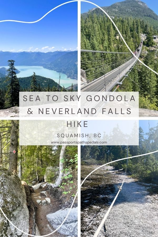
Neverland Falls Hike & the Sea to Sky Gondola
I had never taken the Sea to Sky Gondola. It always seemed a little touristy, a little expensive, and — I’ll be honest — a little like cheating. If you’re a hiker, you’re supposed to earn your elevation, not ride it.
Then I looked up the alternative.
The Sea to Summit Trail is a 7.5km route that climbs 918 metres over 3.5 to 5 hours — a serious mountain hike in its own right. Stacking that onto the Neverland Falls hike would have made for a very long, very hard day. Suddenly, the gondola didn’t feel like cheating. It felt like sound decision-making. For this day, anyway.
I decided to treat myself for my birthday. A gondola ride, a hike I’d been wanting to do, and then to a spa afternoon. A day entirely on my own terms.
Neverland Falls Trail Details
| Location | Squamish, BC — via Sea to Sky Gondola |
| Distance | 10 km |
| Elevation gain | 687 m |
| Time | 3 hours 45 minutes |
| Type | Out-and-back with small loop |
| Difficulty | Advanced/Hard |
| Trail markers | Red diamond markers #1–128 (Al Habrich Ridge); purple diamonds (Neverland Loop) |
| Best season | Late spring to early summer for the falls |
| Gondola | Yes — ~$50 return (2022 price; check current rates at seaandsky.ca) |
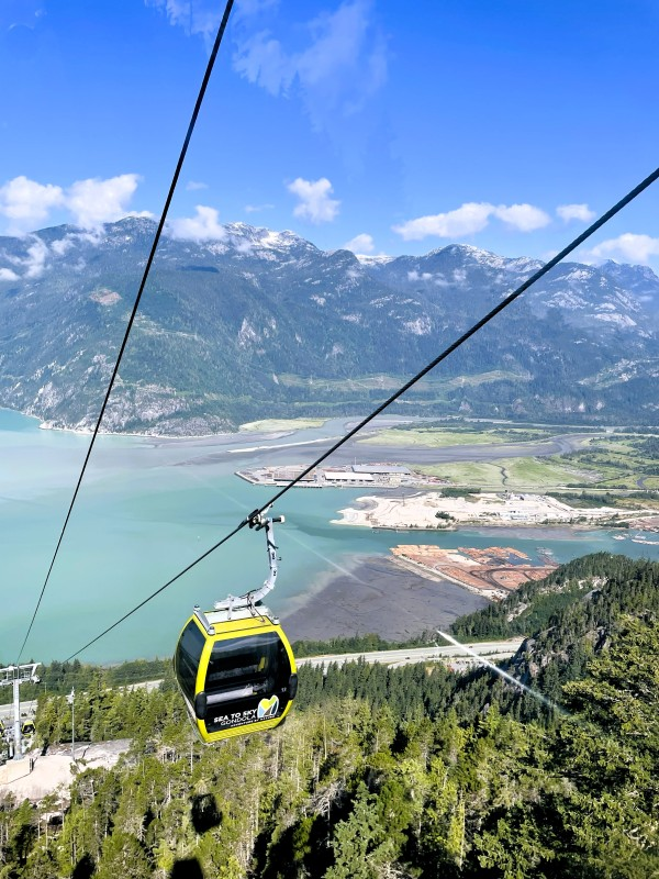
The Sea to Sky Gondola
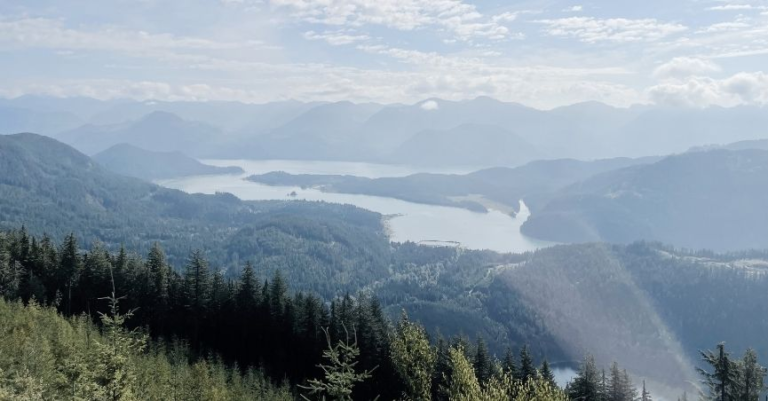
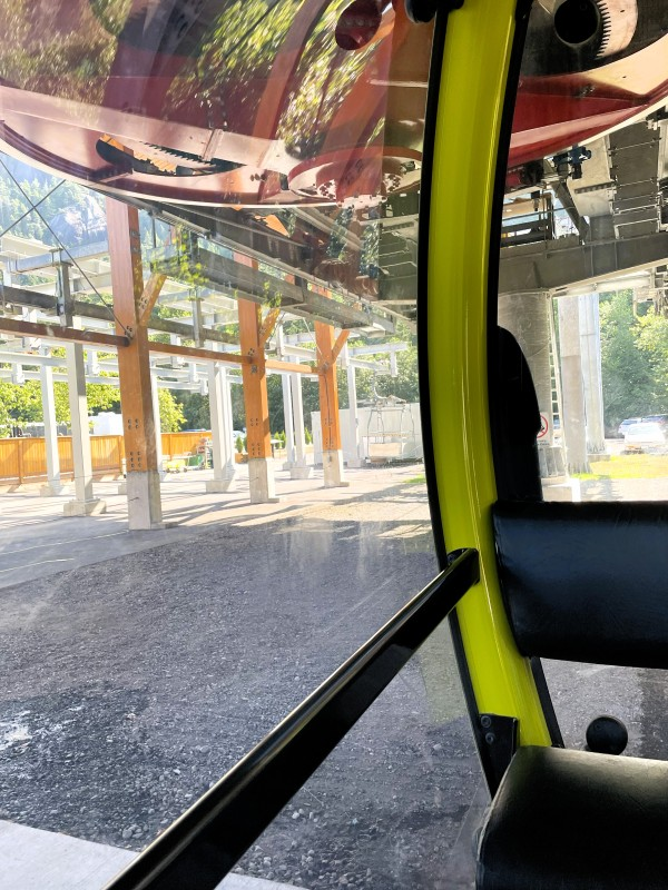
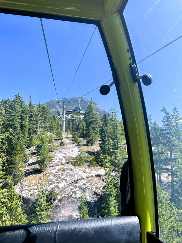
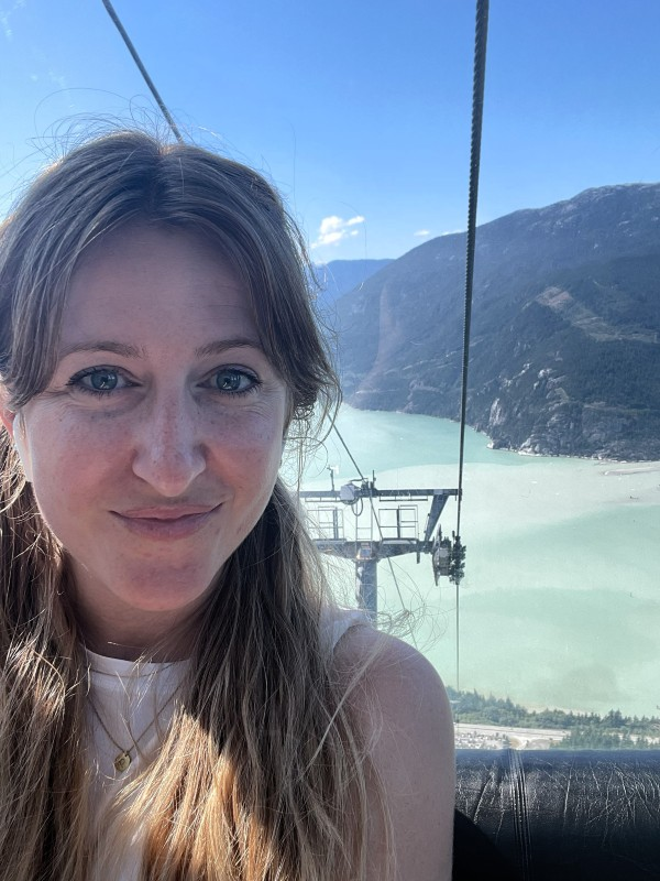
The gondola departs from the base station just south of Squamish and climbs steeply up the mountain — eight minutes of watching the forest drop away below you while Howe Sound opens up in the distance.
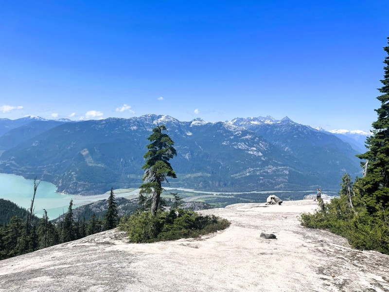
Sit facing away from the direction of travel on the way up. Facing forward gives you the trees and the gondola cable. Facing backward gives you the view — the water of Howe Sound below, pale and luminous near Squamish, where the glacial silt catches the light differently from the deeper ocean blue further out, the scattered islands dotting the sound, the faint blue ridges of mountains disappearing into the horizon. It’s one of those views that produces an involuntary gratitude — that you live somewhere this is accessible on a random day off work, that the world contains this.
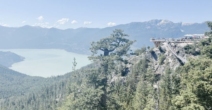
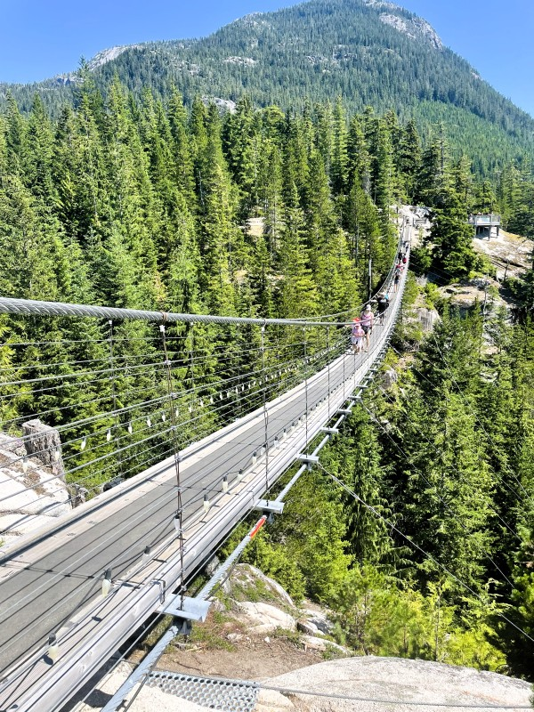
The summit station is a small hub with a café, viewing platforms, and the Sky Pilot Suspension Bridge.
The Suspension Bridge
It’s not that I’m afraid of heights. The gondola didn’t bother me at all. But bridges are something else — too many formative Indiana Jones scenes, probably.
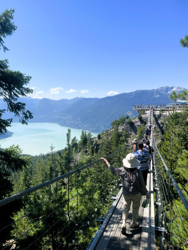
The Sky Pilot Suspension Bridge is approximately 100 metres long, suspended above terrain that falls away dramatically below. What I noticed immediately: the arc of it. The bridge dips down to the centre before rising back up to the far end — that sag is visible and, when you’re standing on it, very much felt. There’s a gentle wobble to it, particularly when others are on the bridge at the same time. I was glad it wasn’t crowded.
The high rope sides help. The wooden deck helps less — there’s something about seeing through the gaps to the mountain below that activates a very specific part of the brain that would prefer you to be somewhere else.
I crossed it. I’m glad I did. The views from the bridge are more of the same extraordinary Howe Sound panorama — the water, the tree-covered slopes, the jagged peaks fading to pale blue in the distance — but elevated, exposed, and with the particular intensity that comes from being slightly scared while looking at something beautiful. Late afternoon light on this view would be extraordinary; I was there shortly after opening with the sun high, and even then, it was hard to leave.
The Hike: Al Habrich Ridge to Neverland Falls
Getting Started: Away from the Crowds
My main goal was never the gondola or the bridge. I was there to hike. Specifically, to chase a waterfall.
From the summit buildings, the route follows Shannon Creek Road — essentially walking away from the gondola infrastructure and the day visitors. Within a few minutes, the crowds thin to almost nothing. I barely saw another person for the rest of the day, which is a remarkable thing to say about a trail accessed via a tourist gondola.
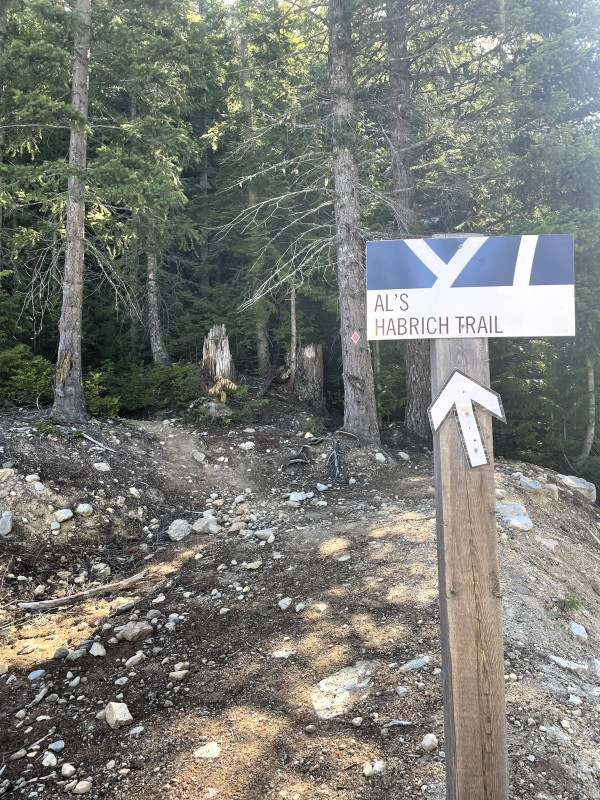
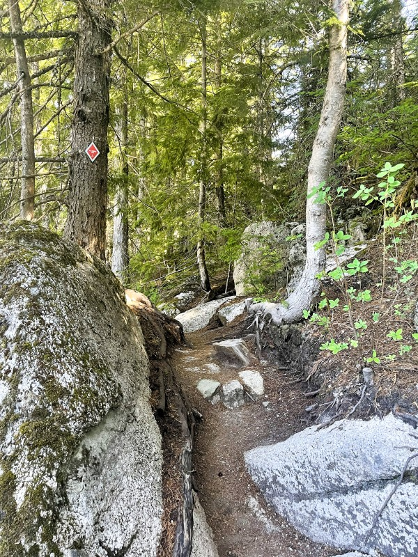
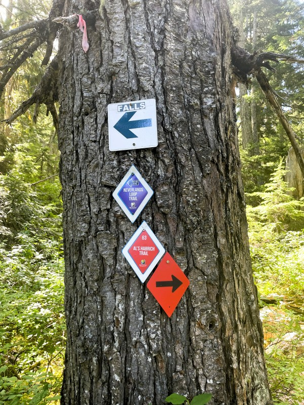
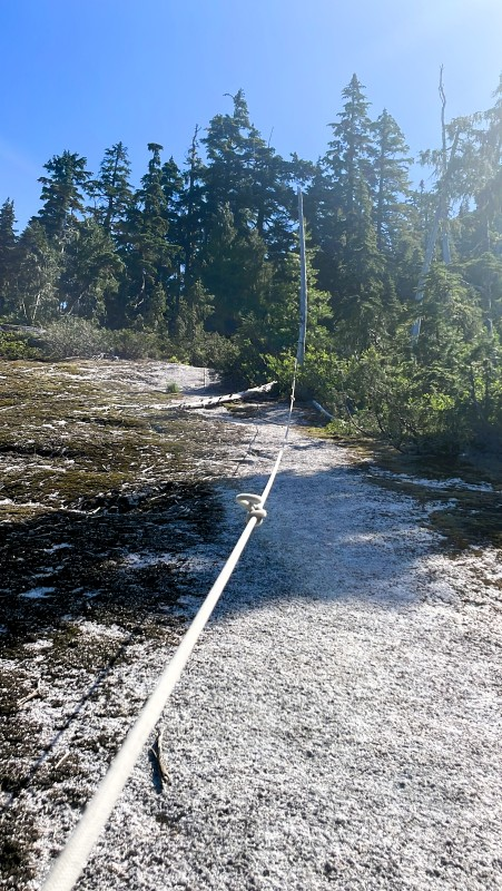
The route follows Al’s Summer Route to the Al Habrich Ridge Trail — named for Samuel Habrich, a local pioneer and prospector who helped map these routes through what was then genuinely wild terrain. The summer route is the first left-hand turn off Shannon Creek Road. Look for the red diamond markers numbered 1 to 128 — the trail is generally well-marked, though the network gets more complex as you gain elevation and reach the rocky bluffs above the treeline.
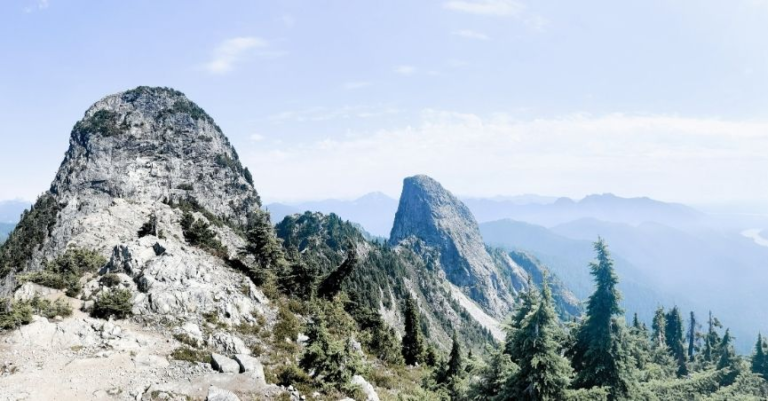
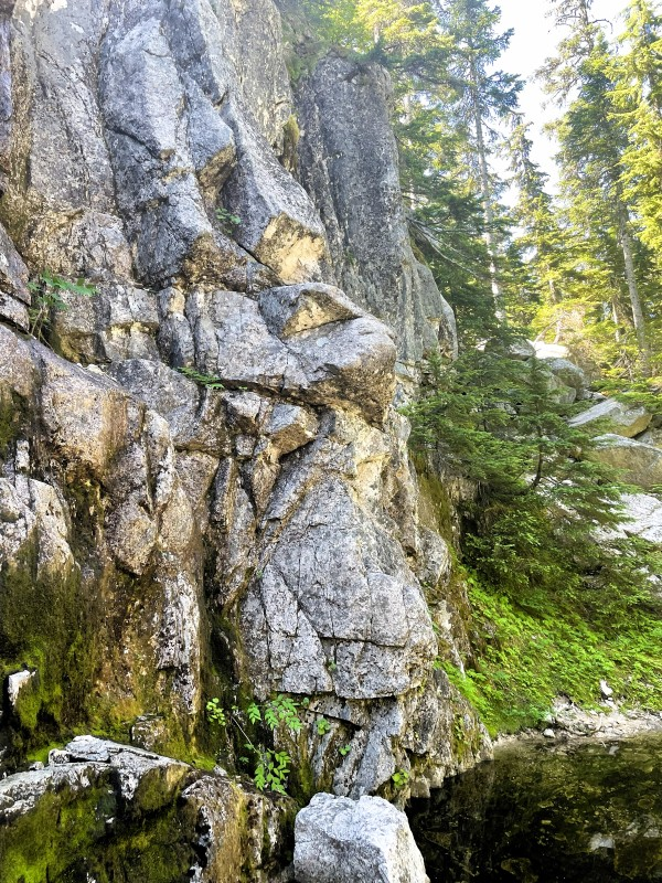
The Rocky Bluffs
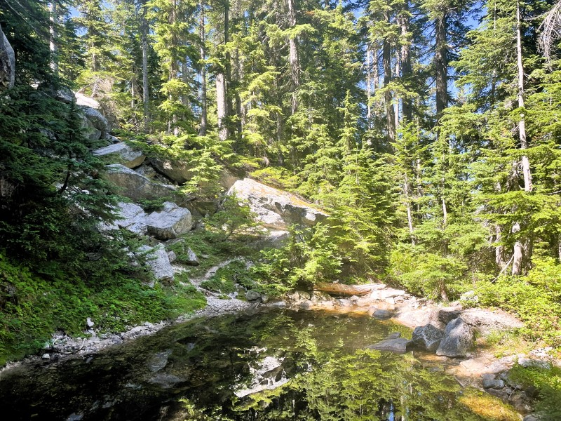
The trail climbs through a landscape that shifts as you gain height: old-growth forest with yellow cedars giving way to sub-alpine grasses and wildflowers, ancient glacial formations, and small creeks crossing the path. The terrain underfoot is mostly dirt, with plenty of exposed rock and roots that demand attention. This is not a trail you can zone out on.
The rocky bluffs section is where I lost the trail briefly — and then again, and then once more. The markers are there, but on open rock, the route isn’t always obvious, and without a clear path to follow it requires some awareness of your general direction. I backtracked a few times after finding myself at sections that didn’t look crossable.
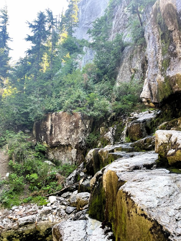
One of those wrong turns led to an excellent viewpoint looking out over Howe Sound — the same view from a different angle, the water and islands and ridgelines stretched below, the trail network visible in patches through the trees below. I spent longer there than I planned to. Worth every minute of the detour.
The Neverland Loop
I took a side route to Yuko’s Pond — a wrong turn brought me back to the main trail eventually — before reaching red marker 55 and the turnoff for the Neverland Loop, marked with purple diamonds. This is the section the hike is named for, and it earns its character.
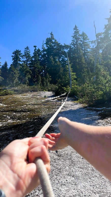
The loop includes rope-assisted scrambles — sections of steep rock slab where fixed ropes help you haul yourself up and lower yourself down. The first one made me hesitate. By the third, I was enjoying them — that particular combination of physical engagement and mild exposure that makes you feel competent and slightly alive at the same time.
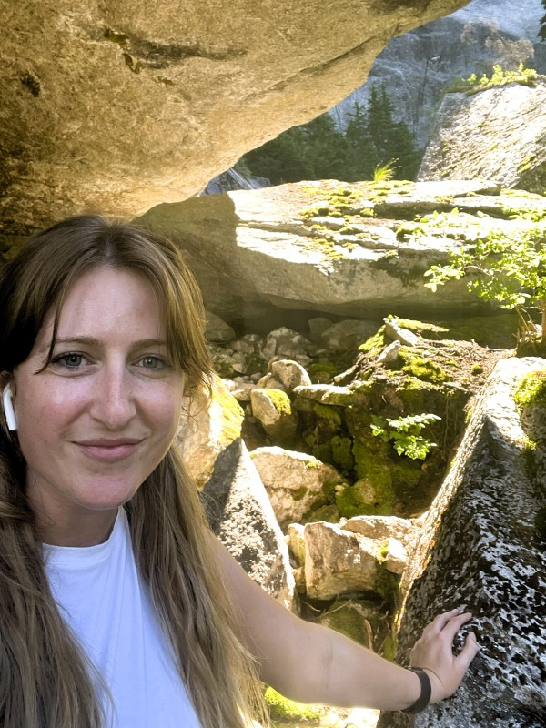
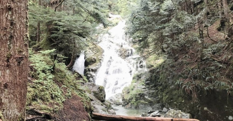
Neverland Falls: The Honest Report
It was August. It had been a hot, dry summer. The trail guide clearly notes that late spring and early summer are the optimal seasons for the falls. I knew this going in. I hoped for the best anyway.
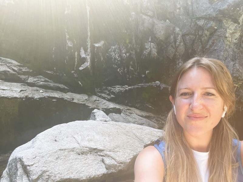
The falls were a trickle. A thin line of water running down the sheer rock face — present, technically a waterfall, but not what the name conjures. It almost looked like it didn’t belong there, like the remnant of something that had mostly given up for the season. Spring water running everywhere after snowmelt is one thing; this was the opposite, a place where there was supposed to be significantly more water.
Honestly? A little disappointing. The trail guide was right, and I’d been warned. I didn’t continue to the Upper Falls — the same conditions would likely apply, and the extra distance didn’t seem worth it.
What wasn’t disappointing: the journey to get there. The rope scrambles, the rocky bluffs viewpoint, the old-growth sections, the solitude, the wildflowers. Neverland Falls in late spring, running properly, with the swimming hole below full and cold — that’s the hike to do. Mid-August is the time to do the hike, as the waterfall may not be flowing.
There are technically swimming holes below the falls, but they are also minimal in late summer. Come back in June.
The Return
Back the way I came — completing the Neverland Loop, returning to the Al Habrich Ridge Trail, and following it back to the gondola station and what felt like re-entering civilization. The descent on tired legs, picking through the rocks and roots, requires the same attention the ascent did. Allow time for it.
A Note on Solo Hiking Safety
This felt like the right place to be honest about something.
I hiked this route alone, in the backcountry, with a bell but no bear spray. I had told people I was going hiking, but hadn’t set a specific check-in time — meaning if something had gone wrong, it might have been hours before anyone started looking.
I’d do it differently now. If you’re hiking solo in the Sea-to-Sky backcountry — or anywhere in BC — the basics are worth taking seriously:
- Carry bear spray and know how to use it — a bell reduces surprise encounters; spray is what you use if one happens anyway
- Set a check-in time with someone at home — “if you haven’t heard from me by 6 pm, call this number.”
- Download the trail offline before you go — cell service in this area is unreliable
- Tell someone your specific route, not just “going hiking near Squamish.”
The trail is beautiful and worth doing. Go prepared.
What I’d Do Differently
Come earlier in the season. Late spring to early summer for Neverland Falls — May or June for proper water flow and the swimming holes. The gondola and the ridge trail are worthwhile any time, but the falls are the named destination, and they deserve a proper showing.
Budget a full day. The gondola opening hours shape your window — arriving at opening and leaving on one of the last gondolas gives you the maximum time above. Three hours and 45 minutes was right for this route, but having more time to linger at the bluffs viewpoint or explore side trails would be good.
Add Shannon Basin. The Shannon Basin trail area looked interesting from the ridge — worth exploring on a return trip as an additional loop.
Practical Notes
The gondola Round trip was approximately $50 in 2022 — prices will have increased since then. Check current rates at seaandsky.ca before you go. The gondola has seasonal operating hours; confirm before planning your visit.
Trail navigation Download the route to AllTrails or Gaia GPS before leaving — the trail network is more complex than it appears on a basic map, and cell service above the gondola station is unreliable. The numbered red diamond markers are your primary navigation tool; memorize where you’re going on the map before you leave the summit buildings.
Difficulty: This route is listed as advanced. I’d call it a hard intermediate — strenuous and requiring navigation attention, but not technically demanding for experienced hikers. The rope-assist sections are fun rather than scary once you’re in them.
Dogs: Check current regulations before bringing dogs — some sections of the gondola-accessed trail network have restrictions.
The gondola direction tip: Sit facing away from the direction of travel on the way up. You’ll thank yourself.
Plan This Trip
This is a great solo day trip from Vancouver — 90 minutes up the Sea-to-Sky Highway, a gondola ride, a proper mountain hike, and home for dinner. Exactly the kind of day that fits around a full-time schedule.
| Getting there | Drive Highway 99 north from Vancouver — ~1 hour to Squamish |
| Gondola | Sea to Sky Gondola — check current prices and hours |
| Where to stay | Search for Squamish accommodation if making a weekend of it |
| Combine with | Stawamus Chief hike, Shannon Falls, Squamish town |
| Best season | Late spring to early summer for the falls; gondola and ridge trails are excellent all summer |
Pin me for later
You might like these other BC Hiking posts: