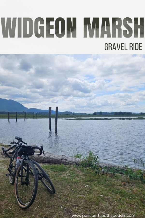
Widgeon Marsh Park Gravel Bike Ride
I almost didn’t write this one.
Not because it wasn’t worth writing about — but because it felt like the kind of place you find and quietly keep. The Widgeon Marsh gravel bike ride has no dramatic feature, no famous viewpoint, no reason for it to be busy. And yet the moment you’re on the trail, you understand why we were still talking about it on the drive home. We saw maybe five other people the whole day, despite cars lining Quarry Road in both directions for the nearby hiking trailheads. Five minutes off the road and it felt like we’d slipped into a different world entirely — dense PNW forest, the occasional trickle of water somewhere in the trees, and the specific kind of quiet that makes you lower your voice without thinking about it.
Then we saw a bald eagle fishing in a creek. Then a black bear wandered through a meadow like it had somewhere to be.
Mark grew up riding these routes. He knows the Lower Mainland trails the way you know the streets around your childhood home — by feel, by memory, by which shortcuts are actually shortcuts. Finding somewhere genuinely new is a different experience for him than it is for me. I’m always in new places. For Mark, a trail he’s never ridden in an area he’s known his whole life is a rarer thing. He was more excited than I was, honestly. And watching him be excited about something I was also discovering for the first time — that was its own quiet kind of joy.
We were still raving about the trail on the way home and to friends the next day. So here I am, writing about it. You’re welcome.
Widgeon Marsh Trail Summary
Start options: Widgeon Marsh Parking Lot / DeBoville Slough Trailhead / Fremont Village, PoCo / Waterfront Commons Park, Pitt Meadows
Distance: 10 km (6.2 miles) to 75 km (46.5 miles) depending on start point
Elevation Gain: 230 m (755 feet) up to 520 m (1,700 feet)
Terrain: Mix of packed gravel and paved sections
Type: Out and back
Time: 1–5+ hours depending on route
A bit of Background on the area
Widgeon Marsh sits within the Pinecone Burke Provincial Park area northeast of Port Coquitlam, adjacent to Minnekhada Regional Park and Widgeon Slough — a quiet backwater off the Pitt River that most people only reach by kayak or canoe (we have an upcoming post on this!). Part of the trail only opened about a year ago, which is part of why it still feels untouched. The area is an important habitat for waterfowl, raptors, and — as we discovered — black bears going about their afternoon with complete indifference to cyclists.
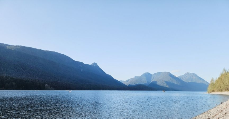
It’s not a destination that sells itself on a single dramatic feature. What it has is atmosphere: old-growth forest, a marshy slough, Golden Ears rising in the distance, and the feeling that you’ve found something most people haven’t bothered to look for yet.


Options for the Widgeon Marsh Gravel Ride
This route scales to whatever kind of day you want. The destination is the same regardless of where you start. Ride with GPS routes linked to the images below.
Shortest (~10 km out and back): Park at the Widgeon Marsh Parking Lot at the end of Quarry Road. Straight to the good stuff, minimal road exposure. Toilets available at the Landing Parking Lot further along.
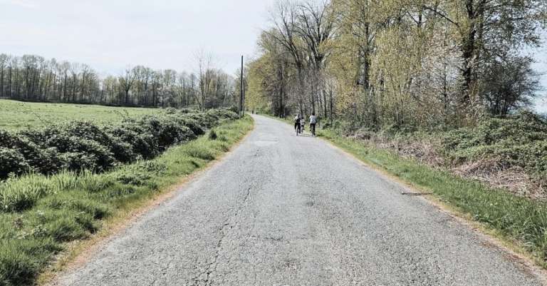
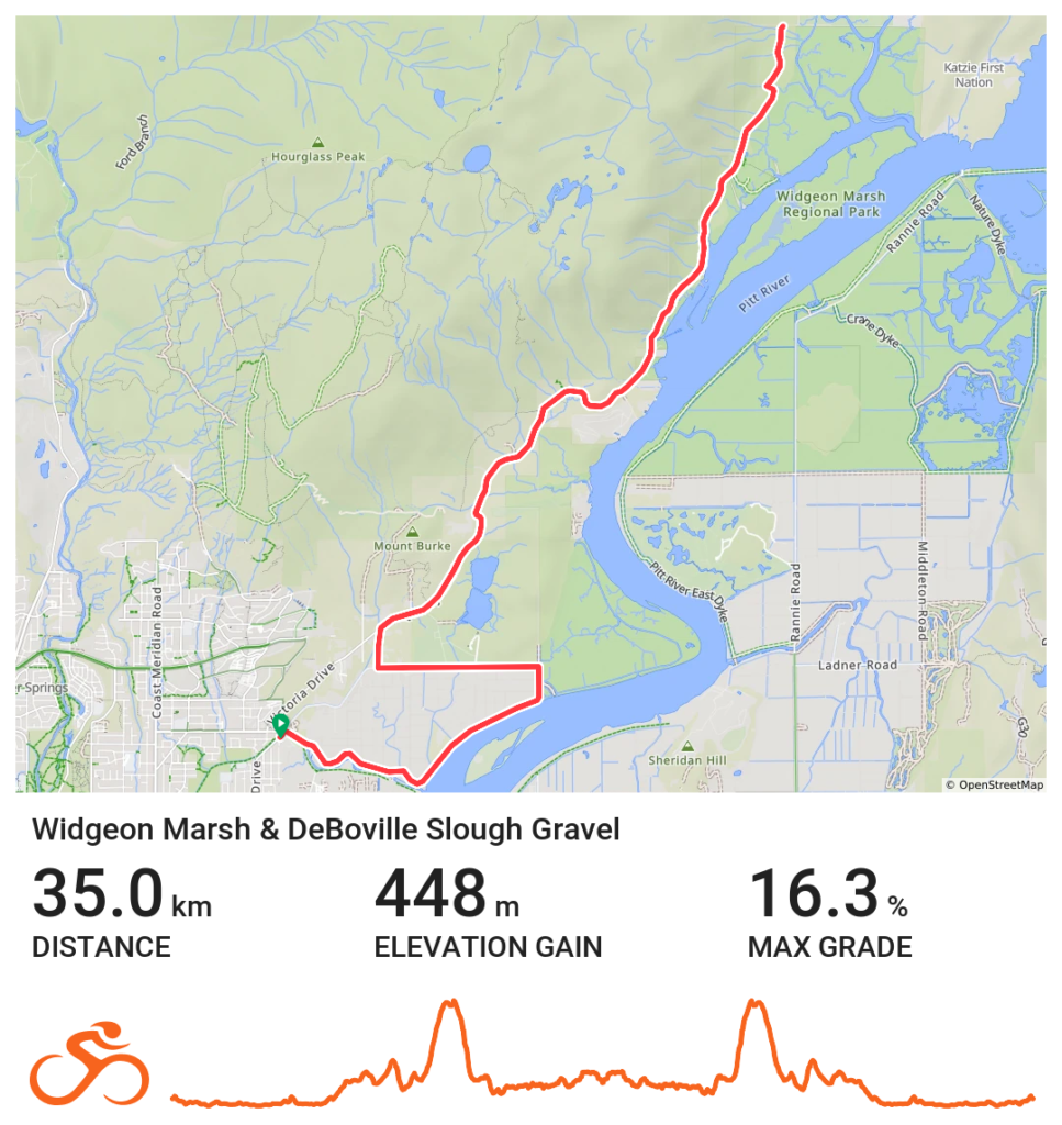
Short (~36 km out and back): Start at the DeBoville Slough Trailhead — a small lot on the south side with a toilet. Pick up the DeBoville Slough North Trail, a raised dyke path between the slough and farmland ditches. At the end of the gravel, turn left onto Oliver Road, right onto Gilley, right onto Quarry Road, and follow it to the parking lot. Fair warning: Quarry Road climbs (448 m elevation gain, with one section hitting 16.8%). More on that shortly.
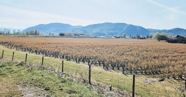
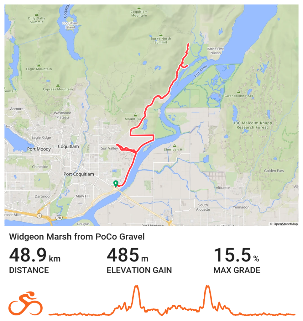
Medium (~50 km, ~485 m elevation, ~80% gravel): Start at Fremont Village in Port Coquitlam. C Market Coffee does a solid pre-ride coffee and pastry, and Tinhat Brewing is nearby for after, though we skipped it on this day, given we still had 45 km ahead of us to get home. Take the Poco Trail along the Pitt River, connecting to the DeBoville Slough South Trail, then Cedar Road to join the North Trail and continue as above. In May, buttercups and scattered purple wildflowers lined the path. Popular trail — expect other cyclists, pedestrians, and dogs.
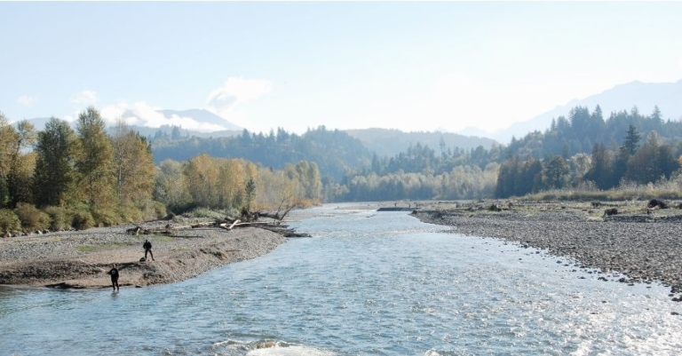
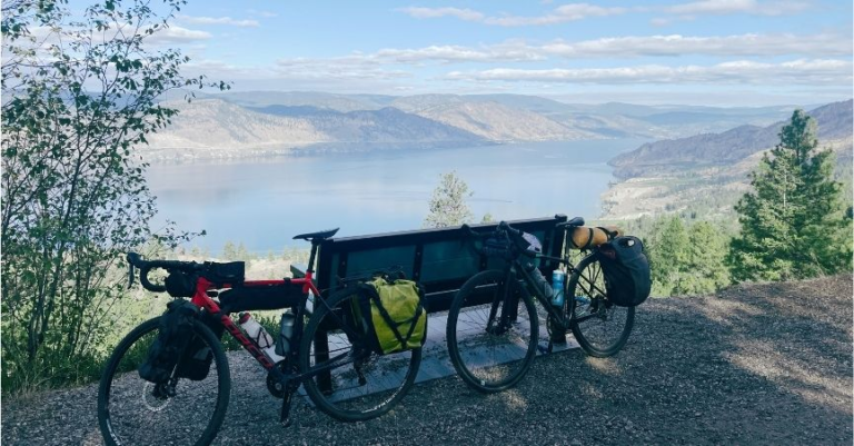
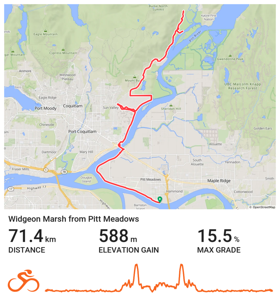
Long (~75 km, ~520 m elevation, ~80% gravel): Start at Waterfront Commons Park in Pitt Meadows. Grab a coffee at Stomping Grounds Café first. Ride the Pitt Meadows Regional Greenway past the airport to where the Pitt River meets the Fraser, cross the Pitt River bridge, and connect with the route above. A proper full day.
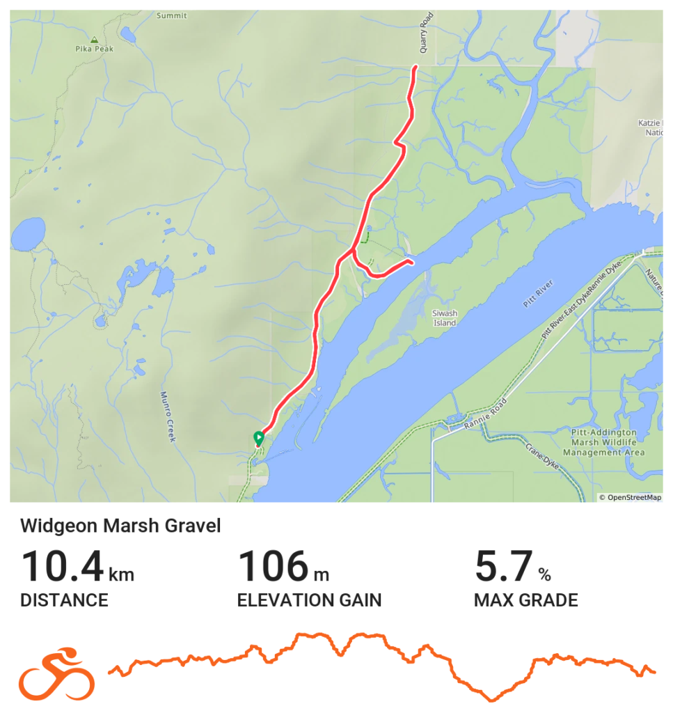
The Widgeon Marsh Trail
From the Widgeon Marsh Parking Lot, you continue along a well-packed gravel road — genuinely nice gravel, not too loose, not too potholed (as of late May 2026). The forest closes in almost immediately. Tall trees draped in vibrant green moss, ferns reaching up through the undergrowth, fallen logs, and shafts of sunlight breaking through where the canopy thins. I can never get enough of PNW forest, and this stretch is a particularly good example — dense and seemingly untouched despite the road running right through it.
You’ll cross a small bridge over a creek. Look downstream. That’s where we spotted the bald eagle, standing in the shallows and fishing with the casual confidence of something that has never once doubted itself.
Continue past a meadow area with outhouses and picnic benches — save this for your return. The paved section eventually gives way to a rougher gravel and rock path, controlled by a gate. As long as the gate is open, you’re good to go. A bit of uphill here, still in dense forest, before the trail ends at the park boundary with a very firm sign making clear you are not to proceed. Turn around.
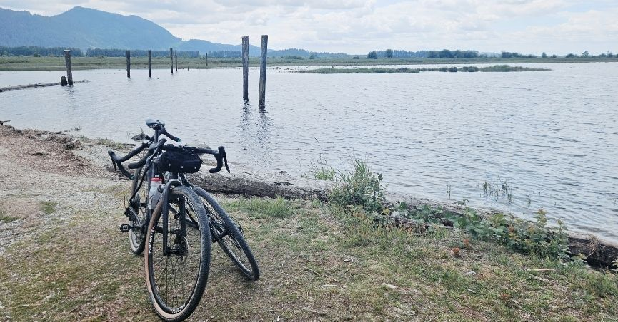
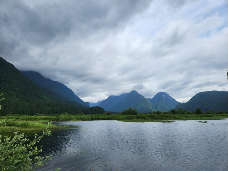
On the way back, when you reach the meadow, take the short side trail out to the marsh — bikes are only permitted on the more western path. It leads to a small jut out over Widgeon Slough with open views across the marsh and Golden Ears beyond. One of those views that makes you stop talking mid-sentence. Soak it in.
And keep your eyes open in the meadow. The black bear we encountered was completely unbothered — just wandering through, doing bear things — but it’s worth being aware.


About that Hill
Let’s talk about Quarry Road, because if you’re starting from DeBoville or further, it’s coming for you.
The climb on the way back is long, with one section that gets legitimately steep. On our way in, we got to the bottom, and Mark said – That’s going to be a pain going back up. I’ve been making real progress with road climbs lately, and I still had to walk part of it. Not a quick rest-and-remount — a proper walk pushing my bike up the hill. Because my legs had reached the point where each pedal stroke felt like pushing from zero momentum, every rotation was a small negotiation with gravity. Mark rode the whole thing. He’s a strong climber from years of mountain biking and a kind of stubborn.
I find gravel riding is harder than road riding, even on flat terrain — the heavier gravel bike on a steep pitch is a different challenge entirely. If you’re newer to gravel or riding a heavier bike, don’t let the elevation numbers fool you. It’ll feel bigger than it looks on paper.


Tips for the ride
- This could easily be a 10 km hike as well, park at the trailhead. Though it is important to note that “no dogs allowed ” is on the Widgeon Marsh trail.
- The gate controls access to the rougher section near the park boundary. If it’s closed, that’s your turnaround point.
- Gravel burns energy differently. Even on flat terrain, the uneven surface works your muscles harder than road riding. There are no resupply options once you’re on the trail — pack more food and water than you think you need.
- Quarry Road climbs. Budget mental energy as well as physical. It’s manageable, but it’s not nothing.
- Don’t skip the meadow side trail on the way back. It’s short, and the marsh views are the best on the whole route.
- Bear awareness. Make noise, stay calm, give it space.
- Minnekhada Regional Park is nearby if you want to combine the ride with a hike.
Pin me for later